 office 23
Bodbury Ring
Church Stretton
Shropshire
England, United Kingdom. (OS Ref. Sheet 137, SO445947)
This small single ditch and bank hillfort sits on top of Bodbury Hill, above the Cardingmill Valley at an altitude of 380m; it possibly incorporates an earlier cross dyke. Bodbury Ring dates from the
Iron Age, circa 500BC, and is of a much later date than the other ancient sites that may be found upon the Long Mind, such as the Cross Dykes and Barrows.
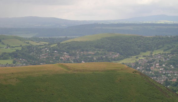
Sitting in the quietness upon its embankments the siting of this small hillfort becomes apparant, the ground to the south and east falls away very quickly, it immediatly overlooks the Cardingmill Valley; dominates the town of Church Stretton and the hillside road that runs over the Long Mynd to Rattlinghope. Traffic moving along a possible ancient trackway, (later Roman Road), between All Stretton and Little Stretton may also be spied upon. The horizon to the north-east is dominated by the hill fort of Caer Caradoc, the settlements on top of The Lawley and in the far distance, The Wrekin.
Today Bodbury Ring is looked after by The National Trust, it is a great place to sit and watch the world go by; great theatre - whether it is the green hills, the hawks in the sky, the bustling activity in the valley below or the man thrashing at a ball with a stick on the nearby golf course.
